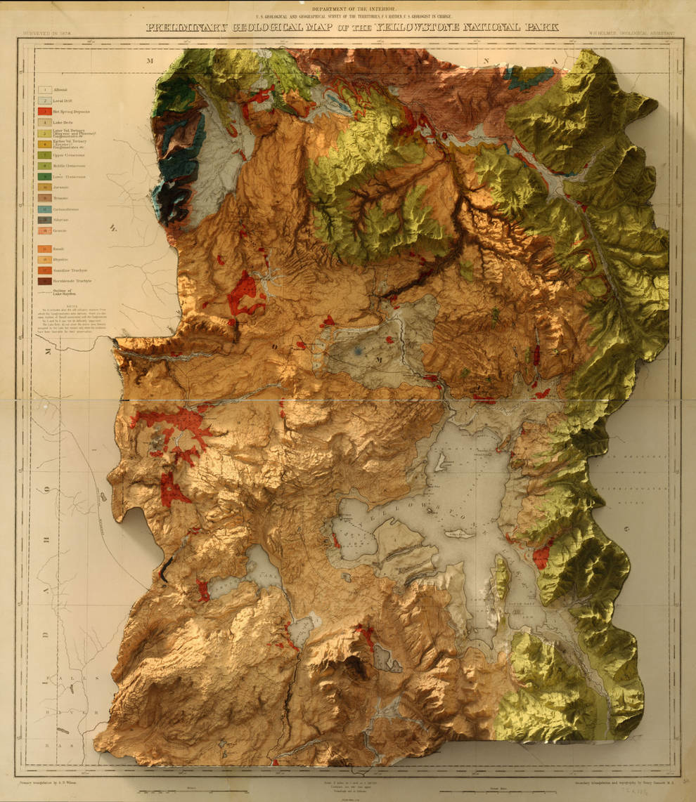
Digital shadows on old maps: a new look at famous landscapes
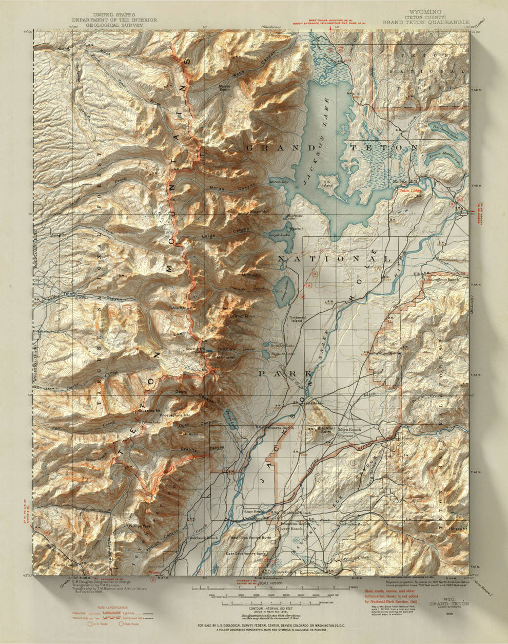
Photo © fubiz.net
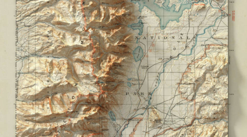
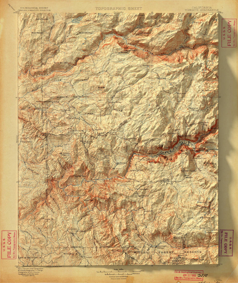
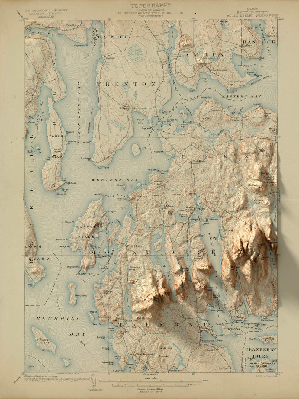
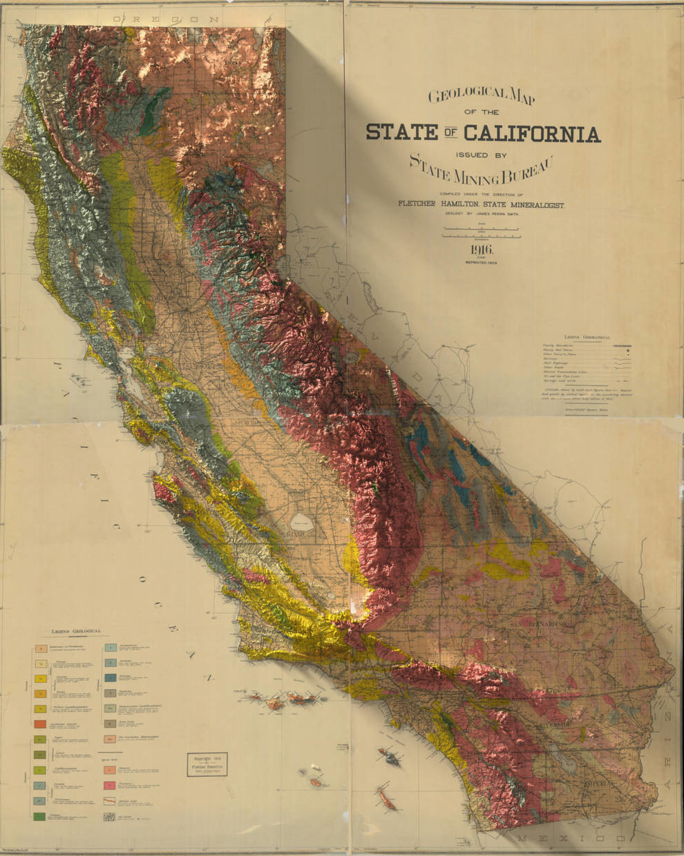
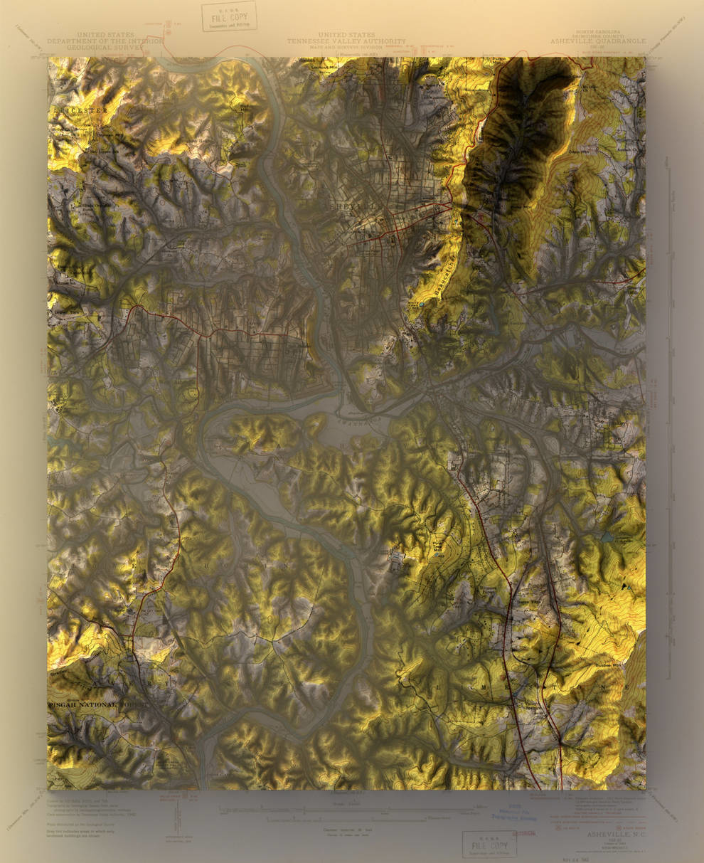
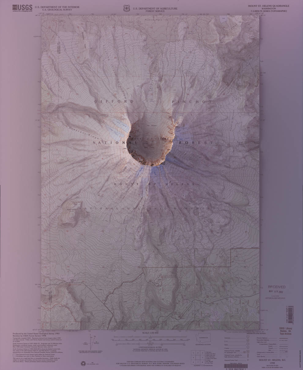
The graphic designer from Brooklyn Scott Reinhard manages to combine modern data on localities with historical maps on which they were previously depicted. To create their work, Scott uses data from the US Geological Survey. He builds information about the location of objects and combines with the design of vintage maps.
These combinations allow Skortta to understand the topography in large areas without using aerial surveys. He learns their history with cartographic information. As a rule, the designer selects familiar places that he visited in person.
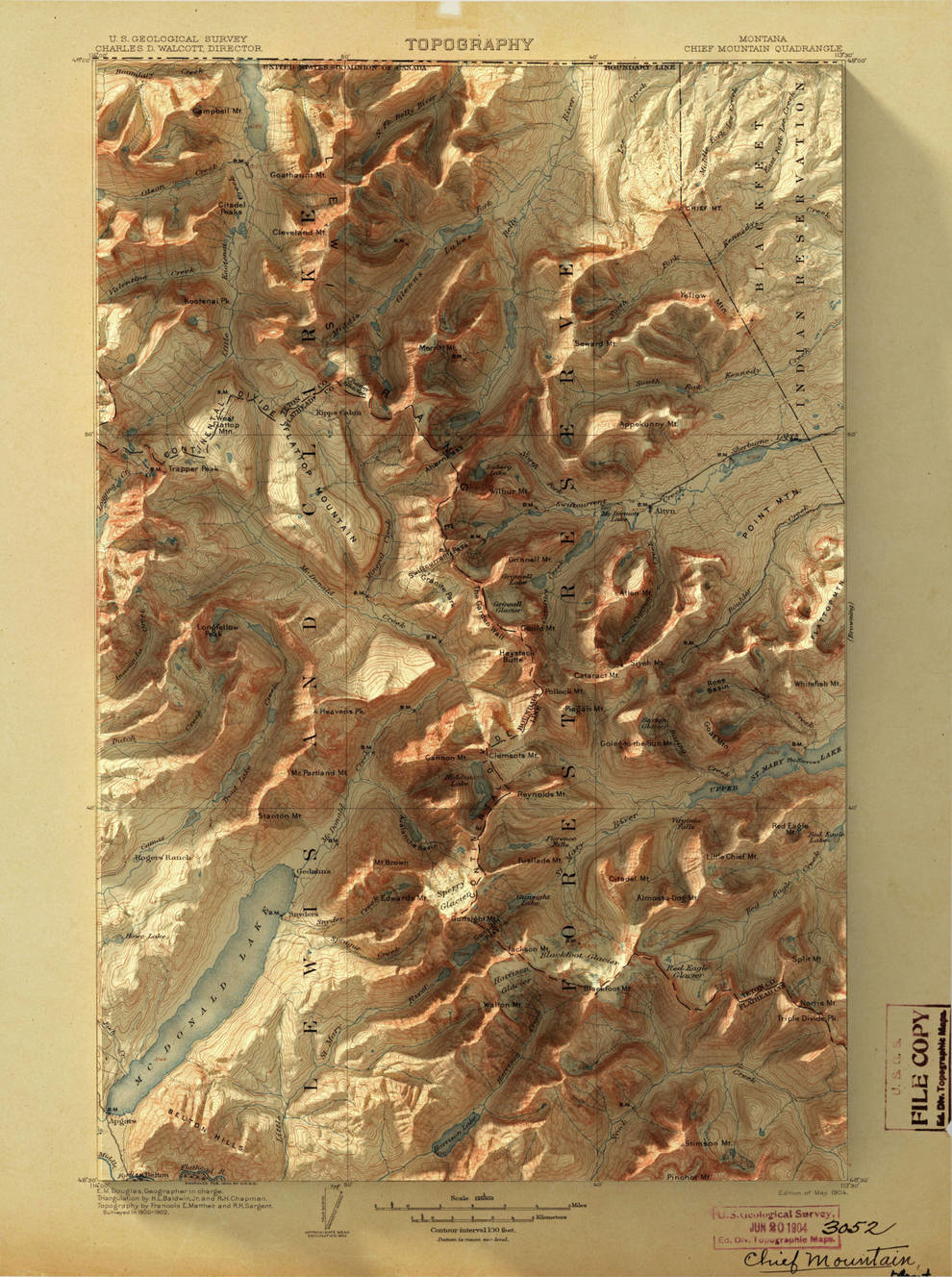
“I'm from Indiana, which has always been so flat and boring. When I began to provide elevation data for the state, a history of the land began. The glaciers that retreated across the northern half of the state after the last ice age formed the land, it became very clear,” explains Scott Reinhard.
Visualizing in this way history, one can notice environmental trends more locally. It shows how it has changed in tens and hundreds of years. But at the same time it is difficult for a person to understand this without a decrease or a glance from above.
Scott Reinhard as a visitor was interested in the idea of using data visually and creating images that would help provide information about the area. It collects and processes a lot of information that is freely available and creates beautiful images from old maps.