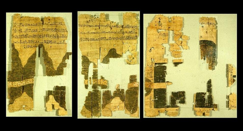
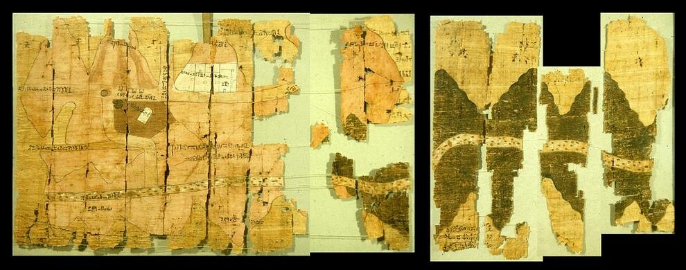
Turin papyrus map: ancient Egyptian plan with geological information
In the Egyptian Museum, which is located in the Italian city of Turin, there is a unique exhibit from the time of Ramses IV-a papyrus depicting the mines that operated in Ancient Egypt. This is one of the most ancient Egyptian maps that provides geological information. On the preserved fragments, you can see a plan of the Wadi Hammamat gorge, where the river once flowed. In addition to the gorge, there are villages, hills, quarries and mines where gold was extracted. In addition, information about the distances between objects is provided.
The map was created around 1150 BC, the Author paid attention to the shrines of the sun God Amon. On the map you can see the places where mount Amon is located, his sanctuary on the Pure mountain, as well as the stele of Pharaoh Seti I. The papyrus was discovered by Bernardino Drovetti, a connoisseur of Egyptian antiquities who served as Napoleon's Consul in Alexandria. The Consul found the artifact in Dair al-Madina, the Theban necropolis where artisans who built the temples of the Valley of the kings and the Valley of the Queens lived in ancient times. After restoration, the total size of the map was 280x41 cm. Even today, however, there is debate as to whether the fragments are positioned correctly.
The map was created around 1150 BC, the Author paid attention to the shrines of the sun God Amon. On the map you can see the places where mount Amon is located, his sanctuary on the Pure mountain, as well as the stele of Pharaoh Seti I. The papyrus was discovered by Bernardino Drovetti, a connoisseur of Egyptian antiquities who served as Napoleon's Consul in Alexandria. The Consul found the artifact in Dair al-Madina, the Theban necropolis where artisans who built the temples of the Valley of the kings and the Valley of the Queens lived in ancient times. After restoration, the total size of the map was 280x41 cm. Even today, however, there is debate as to whether the fragments are positioned correctly.
Photo © ru.wikipedia.org
Photo © ru.wikipedia.org